Book review: A History of Railways in 100 Maps by Jeremy Black

Bookshops are dangerous places, I visited one and came away with A History of Railways in 100 Maps by Jeremy Black! It is a book my dad would have loved.

A History of Railways is approximately A4 format, as well as an introduction it contains eight chapters. The first six of these are chronological and named: Origins, Spreading the New Age (1860-85), Geopolitics and War (1885-1918), Alongside Road (1919-39), War and Air Challenge (1939-70), and Rail Developments (1970-present). It finishes with chapters on “Facing the Future” and “Rail and the Collective Imagination”. Each chapter contains a series of maps, typically they are shown with a facing page of text, occasionally there are two maps associated with a piece of text.

The style of presentation, as a hundred individual maps, makes it a little difficult to pull together themes, although the chapter introductions help with this. Britain features repeatedly but the coverage is global, and Britain’s representation is just a result of the early start made on railways in the country.

The format of maps evolved over the years, as technology improved. Surveying, mapping and printing had developed through the 18th century, prior to the railways, in part to support the creation of turnpike roads and then canals as well as prospecting for minerals for the developing Industrial Revolution. A recurring theme is that the maps rarely present terrain, simply connectivity. Early maps made to promote new lines often featured indications as to what resources (mineral or agricultural) were produced in the areas through which the railway passed. Occasionally there were innovations in presentation, such as using line width to encode freight volumes. In the 20th century novel pictorial formats appeared – advertising for leisurely rail travel.

In Britain railways were not centrally planned but there was oversight via parliamentary act – other countries went for centrally planned systems. Initially many railways were designed to link the production of materials with ports. Railways powered the Industrial Revolution, enabling heavy raw materials to be transported at low cost, and the timely distribution of goods produced. Railways drove the expansion of cities allowing goods, raw materials and people to be brought in daily over significant distances. In Britain rail freight increased more than 10-fold between1850 and 1912. Night travel become more important with signalling improvements.

As the railways grew globally Britain was central in terms of technical know how but also in terms of financing. In different countries the rise of the railways was driven by different commodities – in Uruguay it was beef, in Chile nitrate fertiliser and again linking material production to ports was central.

Prior to the rise of air travel and to a lesser extent car travel, the railways were also associated with luxury enabling pastimes like skiing. I was surprised to learn that the Orient Express service was a locomotive with just three carriages.

In most countries there was a diversity of competing rail companies as the railway systems grew. During the early 20th century there was a tendency for these to merge, many turning out to be uneconomic despite the promises of their developers. This accelerated later in the century as railways declined due to competition from road and air travel.

War features in two chapters, the railways have been central to war for a long time – for troop mobilisation and also to move supplies. During the American Civil War the Union rail network was far more developed than that of the Confederacy which helped them to victory. They are critical even now in Ukraine, for example. In addition to existing railway infrastructure specialised railways were built to support fighting in the trenches during the First World War.

Railways suffered in the post-war periods, typically they had been degraded by attacks and lack of investment during war and then after the war investment was hard to come by. In Britain the 1926 General Strike took a lot of freight off the railways, never to return. Road offers access at all points on a road for low or zero cost. Road vehicles were much cheaper and required limited training. After the Second World War air travel started to take passengers from rail, particularly in Australia, the US and Canada.

In response railways switched to diesel and electric drive reducing costs somewhat but there were widespread managed decline projects such as that of Beeching in the UK. I was surprised to learn that, despite this, American rail freight is quite successful and where they exist passenger services are not doing badly.

There are still grand new rail projects under way such as in Spain, for example, where a high speed rail system is seen as a counter to regional separatist movements. In Asia China’s belt and rail projects are looking to span the continent (despite shipping freight being cheaper). There is a project linking the Baltic states whose existing rail systems focussed on Moscow rather than each other. Delhi is expanding its suburban rail system. In the England HS2 is much reduced largely because it is costing £85 million per kilometre rather than the £13 million per kilometre typical in continental Europe a disparity arising from the large number of tunnels and viaducts built to mitigate local opposition. The COVID pandemic has also led to a 10% reduction in passenger traffic in the UK changing the economics of new railways.

The final chapter of A History of Railways is on various fictional maps and games based on the railways including a map of Sodor, Thomas the Tank Engine’s home island.

This is a beautiful book, the scope is very wide and thus a bit shallow but it provides an interesting overview of the history of railways through vignettes rather than a sweeping narrative.

Book review: This way up by Mark Cooper-Jones and Jay Foreman

My next review is of This way up: when maps go wrong and why it matters by Mark Cooper-Jones and Jay Foreman – a book about maps with something wrong with them, sometimes the errors are accidental but others are deliberate. It is based on the authors’ YouTube channel – Map Men – which has a rather broader scope.

The style of the book is very relaxed but varies from chapter to chapter, one is a podcast transcript, whilst another is a series of fictional letters. One chapter is one sentence long, asking whether a globe is a map (it isn’t).

The chapters are pretty much entirely independent of one another, although the authors note that Google Maps is a little bit of a recurring theme.

This Way Up sometimes talks about when maps are just wrong, for example IKEAs world map which omitted New Zealand, this mistake is sufficiently common that there’s a MapsWithoutNZ reddit. Related to this are erroneous maps on the TV. Both of these arise from the technical process of getting maps into production.

All maps are likely “wrong” because they contain fake places known as copyright traps to catch out people copying them – the chapter on this involves the fictional town of Aglow in the Catskill mountains which has been cited as a copyright trap but mysteriously became a real place – perhaps so that a copier could avoid a copyright challenge!

Some maps are “wrong” for political reasons, in disputed territories such as Kashmir or Taiwan. The UK has a relatively benign version of this, it is now illegal for public bodies to put Shetland in a box in public maps. I struggled with this chapter because it was written as a poem!

In the Soviet Union maps were routinely censored or rendered inaccurate for reasons of secrecy, an exercise in futility once satellite imagery became routinely available.

There are a couple of maps on the birth and growth of the United States, one illustrates it is ill-advised to base borders on vaguely known geography. The northern border with Canada in the west was based on the north west extremity of the Lake of the Woods – a rather intricate body of water, and a projection west to the Mississippi River which it turned out didn’t go so far north. The second map relates to the Donner Party, a group of American settlers heading out to California whose voyage ended in cannibalism. They had left Independence in Missouri rather late in the season which meant they risked being caught by snow in the Sierra Nevada mountains. As a result of this time pressure, they elected to take the “Hastings Cutoff”, a route promoted with a map – inaccurately as it turned out – which would have saved them time.

The “Mountains of Kong” appeared on maps of West Africa following James Rennell’s 1798 map, they persisted through the 19th century and have actually appeared on a map published in 1995. They don’t actually exist, which has been known since about 1890. Rennell had added them to his map on the basis of very limited information and with a desire not to leave blank spaces, his maps were used as the basis of further maps since original cartographic information was in short supply.

I liked the idea of the Situationists who got their own chapter illustrated by the two authors attempting to meet up in London using a map of Paris. The Situationists were an anti-capitalist French group formed in 1957 who believed in making spectacles, and one way of doing this was to navigate a city at random, using the “wrong” map helps this process.

Technically interesting was the creation of the ITV regions in the UK, these arose from the 1954 legislation to end the BBC monopoly on broadcasting (the campaign for this used the slogan “freedom of the knob”!) . The regions were sometimes culturally illogical because transmitters were costly and worked by line of sight, this meant that, amongst other things, South Wales was grouped with Bristol. Also interesting that London had two franchises, one for weekdays which went to Thames and the other for weekends, won by London Weekend Television! The ITV regions were part of my youth, they went into decline when Channel 4 was launched in 1982, and further when the franchises were auctioned in the early nineties.

I’ve read before about the issues of mapping in India, it features in The Address Book by Deirdre Mask. In the city slums many streets are nameless largely as a result of their informal creation but also because the Indians were left with many colonial street names which they didn’t particularly like. In This Way Up addresses and directions in India provide an opportunity to talk about Google’s efforts to improve direction descriptions by the use of landmarks which is how people in Indian were found to describe routes. Actually this is more generally true, I may be vague about street names in my area but I definitely know the landmarks.

The Marshall Islands were very intensively mapped by the Americans prior to the post-war atomic bomb tests conducted there which led to the invention of the more powerful fusion bomb. The surveys were done so that the impact of those tests could be measured. They produced bigger explosions than expected leading to the evacuation of a number of the islands due to long-lived fallout, a number of smaller islands were entirely erased from the map. Also in this chapter were the stick maps that the Marshall Islanders used for navigation.

The final chapter talks about the coming of sat nav and the Google Map, tracing route finding technology from Roman itineraries to a medieval version of such; a scrolling itinerary linked to the turning of a cars wheels from the 1930s (the Iter Avto); audio itineraries, recorded on tape, from the early seventies; the Philips Carin digital map finally resulting in the sat nav we now today which was a luxury car add-on in the nineties and then in everyone’s hands in the form of the smartphone from 2009.

An excellent book for holiday reading, not so good if you are looking for something a little more academic.

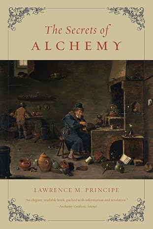
Book review: Alchemy by Philip Ball

I seem to have been on a run of illustrated books, perhaps as a result of regular visits to a local bookshop, illustrated books have more shelf appeal! This review is of Alchemy by Philip Ball with the lengthy subtitle; An Illustrated History of Elixirs, Experiments, and the birth of Modern Science. My copy is a larger format hardback book: a little shorter than A4 but about as wide. The illustrations are well-reproduced and mixed with the text although each chapter finishes with a series of illustrations with captions.

The book is divided into nine thematic chapters which are very roughly in chronological order. They cover the origins of alchemy, key interests of alchemists, laboratory equipment and the transition to modern chemistry with a final chapter on alchemy in culture.

Ancient Egyptians were key to early alchemy, making sophisticated glassware by the mid to late 15th century BC – the earliest glass dates to 2500BC. They were also making a wide range of chemical preparations including dyes, glazes and cosmetics.

The earliest Egyptian texts regarding alchemy date to the 3rd century AD, they were subsequently translated and greatly expanded by Islamic scholars towards the end of the first millennium from there they entered Europe during the Renaissance. Alchemists were also active in India and China from around at least the beginning of the Current Era.

Alchemy seems to have been prone to poorly attributed texts. For example, many texts are attributed to Jabir ibn Hayyan who probably lived in the 9th century – the broader corpus which he can’t have written is referred to as by “pseudo-Geber”. I wonder whether this issue is more widespread in early writing – a result of the pre-print mechanisms of publishing – rather than just an issue with alchemy.

In common with other scientific and artistic enterprises, alchemists often relied on royal patronage – Holy Roman Emperor Rudolf II (1552-1612) was a keen patron of alchemy in Prague.

Alchemy led to the birth of the laboratory as a separate space filled with a range of equipment which looks familiar even now. A variety of heat sources were central to this, alchemists were referred to as “puffers” as a result of their use of bellows to drive furnaces. The crucible, found in the lab today, comes from the Latin for “little place of torment”! Crucibles from the Hesse region of Germany were particularly sought after – it seems the local clay was very conducive to making crucibles. The bain-marie was invented as an alchemical tool by a, possibly mythical, female alchemist. Distillation, an important process even now, goes back to the 2nd millennium BC.

Converting other metals into gold, transmutation, was a primary concern for Western alchemists for pretty much the entire period that alchemists existed. The earliest bronze, made around 3500BC, was made by heating mixtures of ores not the pure metal, pure tin – one of the components of bronze, was not isolated until 1800BC. Our modern idea of elements dates is fairly recent, dating back to the 17th century. In the beginning the different elemental metals were not easily distinguishable from mixtures or even other elemental metals. Metal workers knew that rocks could be transformed to metals, and that metals could themselves could be transformed.

So why not transmutation? Even Robert Boyle, writing in the 17th century, was not convinced that transmutation was impossible.

Once elements were “discovered” it was realised that converting one element into another element (gold) is impossible. There is a proviso here though, 20th century atomic physics shows that elements can be transformed into other elements by nuclear processes but not by the chemical processes to which alchemists had access. As the physicist Ernest Rutherford said to his colleague Frederick Soddy “For Mike’s sake, Soddy, don’t call it transmutation. They’ll have our heads off as alchemists!”.

Transmutation was not the only subject of alchemical study, as well as broader chemical studies, in the East the search for elixirs to extend life was of more concern. Presumably more esoteric alchemical work sat alongside what we would now consider to be industrial chemistry.

In the West Paracelsus was creating a new sort of medicine based on chemistry rather than the four humours of ancient Greece. Philip Ball has written a biography of Paracelsus which I reviewed here. There’s a parallel here with the alchemists starting to break away from the classical elements (earth, water, fire, air, and aether) – in the same way that Copernicus and Galileo were breaking away from the Ptolemaic model of the universe.

It’s worth noting that the ability to make gold from other metals was potentially disastrous from an economic point of view – attempting to make gold was banned by both the Pope and Henry IV in the 14th and 15th centuries. The search for the philosopher’s stone (a material to carry out transmutation) came to be seen outside alchemy as both a fraudulent activity for some alchemists and a road to ruin for others, it was a byword for obsessive pursuits. Esotericism was long a feature of alchemy, the idea of keeping knowledge only for select adepts.

Throughout this review I have struggled as to when to write “alchemy” and when “chemistry”. Robert Boyle’s 1661, The Skeptical Chymist is often cited as a polemic against alchemy but it was more an effort to identify what was good and what was bad in alchemy to build what was to become chemistry. Some 20th century historians of science were dismissive of alchemy, seeing it as mysticism, hopeless causes and fraud perhaps influenced by the alchemy revival in the 19th century, which focussed on the spiritual side of alchemy. The alchemy Ball describes is one of chemicals, processes and a system of the world which transformed into modern chemistry through the 17th and 18th century with the loss of its mystical, and fraudulent elements.

Alchemy has always been referenced in wider culture, we still talk about alchemy now to reference processes which are almost magical in their effectiveness. I enjoyed this book, it has prompted me to seek out more books about alchemy – Ball includes a useful list of further reading.

Book review: Horses by Ludovic Orlando

My next review is of Horses: A 4,000-year genetic journey across the world by Ludovic Orlando (translated by Teresa Lavender Fagan).

It is a product of the work that the author did as the leader of a team of scientists and archaeologists on the evolution of the domesticated horse. The core of this work was to sample horse remains over a wide span of time for DNA to identify where horses were domesticated and how they evolved over time. The book is scattered with vignettes of the scientists and archaeologists with whom he collaborated.

There are eleven thematic chapters, covering the origin of the domesticated horse, the origins of horses in different parts of the world, mules, and horses in different periods of time.

It is worth remembering that a little over 100 years ago horses were economically critical, an outbreak of equine flu had a huge impact on the US economy in 1872/3 since much transport of goods and people was by horse. Indeed the severity of the Boston fire is attributed to the inability to move water pumps because of a lack of horses. Globally the number of horses has declined to around 60 million since the end of the 19th century when it was probably around 75 million but against the background of a human population that has tripled in that time.

The genetic work shows that the origin of the domestic horse is relatively recent – dating to 4200 years ago in the Volga-Don valley bordering the Caspian Sea north of the Caucasus – very close to the part of Ukraine that Russia has recently invaded. All modern horses are descended from this domestication with the exception of the wild Przewalski’s horse which are descended from an abortive earlier domestication in the Botai culture of Northern Kazakhstan. Here the horse had been domesticated a little earlier , approximately 5000 years ago, as evidenced by archaeological remains, but no trace of these horses is found in modern horses (aside from the Przewalski’s horse). Prior to the genetic work the location of the domestication of the horse was uncertain, options covered central Europe and Asia, as well as the Iberian peninsula. It was believed that Przewalski’s horse represented a truly wild horse. Orlando covers pre-domestication horses in a separate chapter but does not go into the textbook evolution of the horse from eohippus.

The domestication of the horse relatively recent compared to other animals. Genetically domesticated horses have two key differences from their wild ancestors, they are more docile and have stronger backs.

Once domesticated the horse spread rapidly across Eurasia, there is a chapter here on whether the Indo-European language group spread simultaneously with the horse but the evidence is that agriculture and language spread before the horse was domesticated but that there was an acceleration around the time of its domestication. Orlando suggests that the key feature of the horse was its ability to carry loads, and that drought in the cradle of its origin drove the migration. It had previously been proposed that the horse had spread via its use in raiding and war-fighting.

Genetics are central to the whole book but don’t really get a consolidated explanation anywhere, I suppose because the details are quite technical and for the reader the key thing is the outcome – for example measuring relatedness and identifying the function of genes which have been selected by breeding. I was curious to learn of the ambling gait for horses, and its origin in a single gene, DMRT3. This is found is specific breeds such as the Icelandic Horse, Peruvian Paso and the Tennessee walking horse. I found the text descriptions of gaits confusing but there are plenty of videos online illustrating the ambling gait, it looks unusually smooth at faster paces.

As soon as humans start domesticating horses the population of horses starts to rise dramatically, human breeders break the rules of the equine social order which greatly increases the breeding capacity. The control breeders exert is even more marked nowadays in the breeding of racehorses. They all have the same notional birthday (1st January in the northern hemisphere) which means that there is a benefit to arranging the birth of foals as close after this date as possible since horses are raced very young and classed by age.

I found the chapter on modern racehorses a bit depressing, the death and injury rates for racehorses particularly in the US is high. Furthermore, genetic defects are persisted deliberately because they confer an advantage in racing the young horse.

There is a chapter on mules, once highly regarded and prestigious both for their “hybrid” vigour and also and their relative scarcity – mules are infertile so they can only be bred directly from donkeys and horses. They were particularly popular with the Romans for use in carrying goods. Also mentioned is the kunga a donkey-onager cross highly valued by the ancient Egyptians.

The chapters on different times and places focus on what we might be able to say about the characteristics of horses from that time or place, so we learn that Medieval war horses were surprisingly small, and that paler horses declined in numbers after the 5th century. The exception to this is the horse in America where the question of whether any of the horses in US have an ancestry outside that originating in Europe – the answer is that they don’t although Orlando talks about their being more work to do in this area.

The book finishes with a chapter on cloning. I was surprised to discover that Argentina seems to have taken the lead on this, cloning polo horses – it has been rather more successful than I expected.

In the epilogue Orlando talks about learning to ride at the age of 42, after he had done the majority of the work in this book!

Book review: The Historical Atlas of the Celtic World by John Heywood

My next review is of The Historical Atlas of the Celtic World by John Haywood, bought in the same spending spree as Ancient Rome Infographics by Nicolas Guillerat, John Scheid and Milan Melocco. The two books are from the same publisher, Thames & Hudson, and were promoted together but they are quite different. I have to say I prefer this book, the graphics are less varied but the story comes through more clearly than Infographics.

The Historical Atlas is divided into 3 parts: The Continental Celts, The Atlantic Celts (Britain and Ireland) and The Modern Celts. Each part starts with a few pages of introduction followed by double page spreads on a range of topics – often a date range for the action is included. Typically these spreads will comprise a map, and some photos or diagrams. Overall it is a well-illustrated book.

The Celtic World is defined by Celtic languages including languages from Gaul (France), Italy and the Iberian peninsula that have long gone extinct. It once spanned central and Northern Europe, from the North of the Iberian Peninsula, across Northern Europe (including the Great Britain and Ireland) all the way to the Black Sea. Genetic evidence suggests origins as far back as 6000BC but the first archaeological evidence goes back to 800BC with the Hallstatt and La Tène cultures. Now all that remains is Ireland, Wales, Scotland, Cornwall, Brittany and Galicia in North West Spain – largely as a result of a revival of Celtic culture starting in the 18th century.

In terms of settlements, hillforts were popular across the Celtic world, as well as oppidum – fortified lowland towns. The British were nearly unique in preferring roundhouses over rectangular buildings found in the rest of Europe. In the North East of Scotland brochs (fortified towers) and duns (small forts) were popular in the later ancient period (500BC-200AD). It was only as the Roman Empire expanded that parts of the Celtic World started to urbanise.

Trade was long a feature of the Celtic World, going all the way from Ireland into the rest of Europe. As contacts with the Roman Empire increased, local Celtic leaders developed a taste for luxury goods. In exchange Romans took chain-mail, barrels, shipbuilding techniques and legionaries helmets from Celts – the Celts were not technologically backward.

Druidism was an important part of Celtic culture, it was not popular with the Romans since it purportedly involved human sacrifice, although it might be wise to take Roman writings on Celts with a pinch of salt – they were trying to justify invading them.

The first written records of Celts date to 600BC by which point they dominated Western and Central Europe. They sacked Rome in 390BC, and made in-roads into Greece for 20 years from 300BC amongst other invasions to the East, these rarely left any archaeological record. The Celtic civilisation was not centralised in the manner of the later Roman Empire, it was a looser confederation with a shared culture rather than power. This meant that when the Roman Empire expanded it was faced largely with smaller battles against isolated tribes and leaders rather than facing off against another empire.

The Roman’s took over the Celtic kingdoms as they started to centralise, failing in Germany where this centralisation did not really occur. The Roman’s invaded Gaul in the 50BCs, with a brief foray into England, which was not successfully invaded until 43AD. Roman dominion largely wiped out the Celtic languages of mainland Europe, although some culture survived. In Britain the South East became increasingly Romanised and urbanised, further to the north and west life continued largely as before.

When the Roman Empire fell Celtic culture did not make a great revival across continental Europe with the exception of Brittany which retained independence from France until 1532. Great Britain fell into its “Dark Ages” with the departure of the Romans, ultimately invaded by the Anglo-Saxons. Ireland, on the other hand, flourished – driven by Christianity and a system of monasteries that stood in for more traditional urban conurbations. The Irish went on to conquer the Picts in Scotland in the 9th century, so Scotland has an Irish origin. Wales had largely been subjugated by the English king, Edward I in the late 13th century. The Reformation triggered the English to take over Ireland, where they had long had a foothold. Later they would push into Scotland during the Jacobite Rebellion with this the Celtic countries disappeared.

However, in the 18th century a Celtic revival started, perhaps originating in the identification of the Celtic language group by Edward Lhuyd in 1707. It fitted with the Romantic idea of the noble savage, and also a desire by the people of Wales and Scotland to make themselves distinct in the newly united kingdom. Celtomania was a Europe-wide movement. The revived Druidism is a modern invention, we know close to nothing of the original Druidism. There was a further Celtic revival in the 1970s. Haywood is somewhat negative about the existing Celtic languages, seeing only Welsh as having a growing future.

I found this an interesting overview, it covers a great deal of time and space with many relatively small players. The double page spreads with maps help make this manageable. I think I was most surprised by the extent of the ancient Celtic world, and the influence of Ireland in the Early Middle Ages.